NASAEARTH is an ambitious and groundbreaking initiative by the National Aeronautics and Space Administration (NASA) aimed at studying Earth’s complex systems from space. Leveraging state-of-the-art satellite technology and cutting-edge scientific research, NASAEARTH provides invaluable insights into various aspects of our planet, including its climate, ecosystems, and natural resources. This article provides an overview of NASAEARTH’s mission, the satellite systems employed, and the significant contributions it has made to our understanding of Earth and its intricate interconnections.
Introduction: Understanding Earth’s dynamic systems and how they interact is crucial for addressing environmental challenges and ensuring sustainable development. NASAEARTH seeks to unlock the mysteries of our planet by utilizing satellite-based observations, advanced data analysis techniques, and collaborations with international partners.
Mission Objectives: The primary objectives of NASAEARTH encompass a wide range of research areas, including:
a. Climate Change: Monitoring and studying Earth’s climate system to enhance our understanding of long-term trends, natural variability, and the impact of human activities.
b. Land Surface Dynamics: Investigating land cover changes, vegetation dynamics, and the impact of land use on ecosystems and biodiversity.
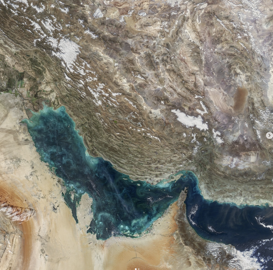
c. Oceanography: Studying the world’s oceans, including ocean currents, temperature, salinity, and the distribution of marine life, to improve our understanding of ocean dynamics and their role in regulating the climate.
d. Atmosphere: Monitoring atmospheric composition, aerosols, clouds, and other variables to advance our knowledge of air quality, atmospheric chemistry, and climate interactions.
e. Natural Hazards: Assessing and predicting natural hazards such as hurricanes, earthquakes, wildfires, and floods to enhance early warning systems and support disaster management efforts.
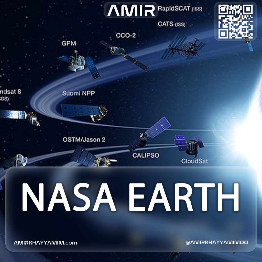
- Satellite Systems: NASAEARTH relies on a constellation of advanced satellites equipped with cutting-edge instruments to collect high-resolution data across multiple spectral bands. These satellites include:
a. Terra: Launched in 1999, Terra provides comprehensive observations of Earth’s atmosphere, land, and oceans, contributing to our understanding of climate change, natural disasters, and ecological dynamics.
b. Aqua: Launched in 2002, Aqua focuses on studying Earth’s water cycle, including the movement of water vapor, clouds, precipitation, and the cryosphere.
c. Suomi National Polar-Orbiting Partnership (S-NPP): Launched in 2011, S-NPP carries a suite of sensors to observe various aspects of Earth’s atmosphere, land, and oceans, providing critical data for weather forecasting and climate monitoring.
- Major Contributions: NASAEARTH has made significant contributions to scientific research and societal applications. Some notable achievements include:
a. Climate Modeling and Prediction: NASAEARTH data has significantly improved climate models, enabling more accurate predictions of future climate scenarios and facilitating informed decision-making.
b. Ecosystem Monitoring: The satellite observations have enhanced our understanding of global ecosystems, including deforestation patterns, carbon fluxes, and biodiversity changes, aiding conservation efforts and sustainable land management.
c. Disaster Response and Mitigation: NASAEARTH’s real-time data and imagery have proved vital in emergency response operations, enabling authorities to assess the extent of damage and plan recovery efforts in the aftermath of natural disasters.
d. Water Resource Management: The satellite-based monitoring of water bodies, including lakes, rivers, and reservoirs, has supported efficient water resource management, particularly in regions experiencing water scarcity or facing potential conflicts over water resources.
Future Directions: NASAEARTH continues to push the boundaries of scientific exploration. Future endeavors include developing advanced sensor technologies, refining data assimilation techniques, and fostering international collaborations to broaden the scope and impact of Earth system science.